Why Storms Get Names: A Look Inside the System That Could Save Your Life
I’ve been a meteorologist for a long time. I’ve flown with the Hurricane Hunters straight into the eerie calm of a storm’s eye, and I’ve stood in emergency operations centers, watching that same storm crawl across a map toward millions of people. In all that time, I’ve learned that one of our most powerful tools isn’t a high-tech satellite or a supercomputer. It’s a simple name.
In this article
A name turns an abstract weather map into a specific, trackable threat. It focuses minds and saves lives. But where do these names actually come from? It’s not random, I can promise you that. It’s a carefully managed global system designed for one purpose: clear communication when it matters most.
Understanding this system isn’t just trivia. It gives you a behind-the-scenes look at how the pros track these massive weather engines and, more importantly, helps you know exactly what to do when you hear a storm name on the news.
Why Do We Even Need to Name Storms?
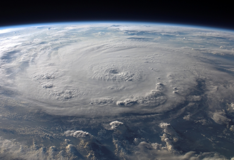
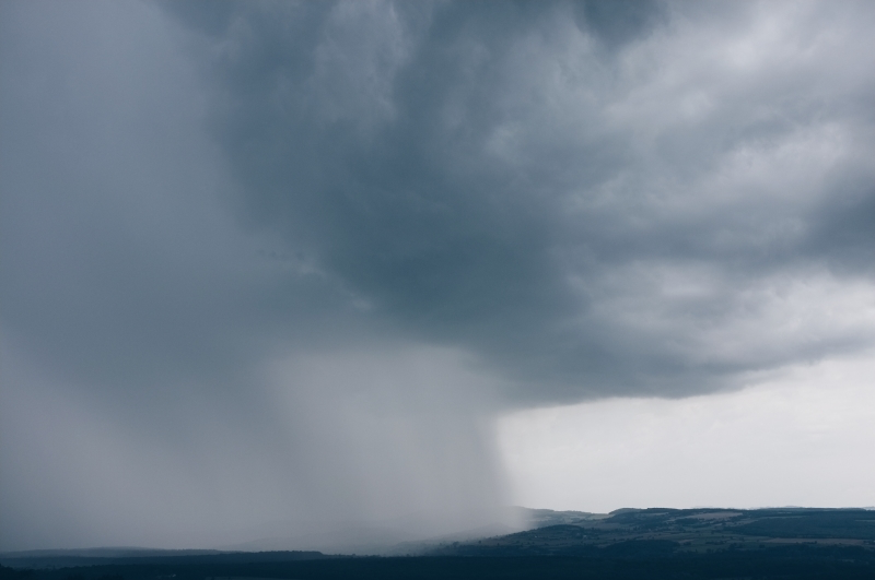
To get why we name them, you have to understand what a hurricane really is. It isn’t just a bad thunderstorm. It’s a long-lived, organized system fueled by warm ocean water that can travel for thousands of miles over days or even weeks.
It all starts when ocean water is at least 80°F (about 26.5°C). That warm, moist air rises, cools, and releases a tremendous amount of energy—the fuel for the storm. As air from surrounding high-pressure areas rushes in, the Earth’s rotation (the Coriolis effect) gives it a spin. Counter-clockwise in the Northern Hemisphere, and clockwise in the Southern. This is what creates that classic spiral.
The Trigger for a Name
So, when does a storm officially get its name? This is a key detail a lot of people miss.
It’s not when it becomes a hurricane. A system is named when its winds reach 39 miles per hour (63 km/h), classifying it as a Tropical Storm. This is your first major heads-up. Once a name is assigned, that’s the signal that the storm is organized and has the potential to strengthen into a hurricane (which happens at 74 mph / 119 km/h).
Think about the old days, before this system existed. A ship captain would get a wireless report of a big storm at a certain latitude and longitude. An hour later, another report comes in for a storm a few hundred miles away. Is it the same one? Or a totally new threat? That confusion was deadly. A single, clear name cuts through all that noise, creating a shared language for everyone from forecasters to your local sheriff.
The Modern Naming System Explained
Today, the whole process is coordinated by the World Meteorological Organization (WMO) to keep things consistent globally. For the Atlantic basin (that’s the Atlantic Ocean, Caribbean Sea, and Gulf of Mexico), they use six lists of names that rotate every six years. So, the 2024 list will be back in 2030.
Each list has 21 names, running alphabetically from A to W (they skip Q, U, X, Y, and Z because common names are harder to find). The names are chosen to be familiar to the people in the region, which is why you see a mix of English, Spanish, and French names. And yes, they alternate between male and female names, a practice that started quite a while back to make the lists more balanced.
What If We Run Out of Names?
In a really busy season, it’s possible to use all 21 names. For a long time, the rule was to switch to the Greek alphabet (Alpha, Beta, etc.). This happened in a couple of hyperactive seasons, and honestly, it was a mess.
Forecasters and the public found the Greek names distracting and confusing. To be frank, a storm named “Zeta” just didn’t sound as threatening as a storm named “Laura,” even if it was just as strong. So, after one particularly brutal season, the WMO committee made a smart change. They created a permanent supplemental list of names to be used if the main one runs out.
Did you know? The first few names on this backup list are Adria, Braylen, and Caridad. It’s a good example of how the system is always adapting based on real-world experience.
Retiring a Name Forever
Sometimes, a name doesn’t get recycled. If a storm is exceptionally deadly or destructive, its name is permanently retired. This is done out of respect for the victims and to preserve the historical record. When you mention certain infamous storms, everyone knows exactly which one you mean.

It’s not just about wind speed; it’s about the total human and economic impact. Think about the catastrophic storm that caused a massive levee failure along the Gulf Coast, or the powerful one that completely rewrote building codes in South Florida. Or the sprawling superstorm that brought a devastating surge to the Northeast. Their names were retired so they would never be used again for another storm.
From Name to Action: Your Preparedness Plan
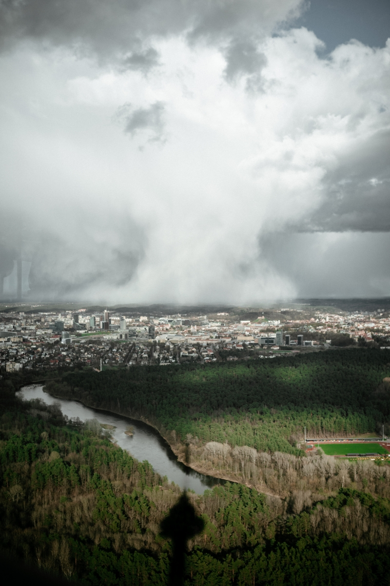
Okay, here’s the most important part. A name makes a storm easy to follow, but it tells you absolutely NOTHING about its specific threats. You have to look beyond the name to stay safe.
I’ve seen people get dangerously complacent because a storm has a gentle-sounding name. But its power has zero to do with what we call it. I remember one storm system that never even reached hurricane status, but it stalled and caused catastrophic, record-breaking flooding. People were caught off guard because it didn’t have that scary ‘hurricane’ label.
First, Know the Lingo: Watch vs. Warning
When a storm is approaching, you’ll hear two key terms. Knowing the difference is critical.
- Hurricane Watch: This means hurricane conditions are POSSIBLE in your area within 48 hours. This is your signal to finalize your preparations. Go over your plan, check your kit, and secure your property.
- Hurricane Warning: This is much more serious. It means hurricane conditions are EXPECTED in your area within 36 hours. If you haven’t finished your prep, you are behind. This is when you should be ready to evacuate at a moment’s notice if local officials give the order.
Pro Tip: Don’t Bother Taping Your Windows!
I see this all the time, and it’s a dangerous myth. Taping your windows in an ‘X’ does not strengthen them. All it does is create larger, more dangerous shards of glass when the window shatters. Your best bet is to install tested and approved hurricane shutters. If you don’t have them, covering windows from the inside with 5/8-inch plywood is the next best thing.
Your ‘First 72 Hours’ Go-Kit
When a storm gets a name, it’s time to make sure your emergency kit is ready. You don’t need to spend a fortune. The goal is to have everything you need to survive without power or running water for at least three days.
- Water: The absolute #1 priority. Plan for one gallon per person, per day. A three-day supply for a family of four is 12 gallons. (Cost: You can find gallon jugs for around a dollar each at most grocery stores).
- Food: Think no-cook, non-perishable items. Canned meats and fish, peanut butter, granola bars, crackers, and dried fruit are perfect. Don’t forget a manual can opener! (Cost: Plan on about $30-$50 to stock up).
- Light & Communication: Get multiple flashlights and a headlamp (so your hands are free). A battery-powered or hand-crank NOAA weather radio is a lifesaver for getting official alerts when the power’s out. (Cost: A decent radio is about $20-$30, and you can get LED flashlights for under $20).
- Other Essentials: A first-aid kit, any prescription medications, sanitation supplies (like wipes and garbage bags), and a portable phone charger or power bank are all critical.
When a storm is named, your first stop for information should be the official source: the National Hurricane Center at hurricanes.gov. They have the real, no-hype forecast. And always, ALWAYS, listen to your local emergency management officials. They are the ones who will issue evacuation orders.
The People Behind the Forecasts
Behind every name and forecast cone is a dedicated team of people. The Hurricane Specialists work around the clock when a storm is active, analyzing staggering amounts of data from satellites, ocean buoys, and computer models.
But the most incredible data comes from inside the storm itself. The U.S. Air Force Reserve crews, known as the Hurricane Hunters, fly heavy-duty aircraft right through the eyewall. I’ve been on those flights. It’s hours of relative calm punctuated by moments of intense, bone-rattling turbulence.
Onboard, they’re deploying instruments called dropsondes that fall through the storm, sending back real-time data on pressure, wind, and temperature. That’s the ground truth. Without the skill and bravery of those crews, our forecasts would be far less accurate, and we’d all be less safe.
The Takeaway
So, a hurricane’s name is much more than a random label. It’s the starting pistol for a global system of observation and communication. It connects scientists, pilots, forecasters, and the public with a common language.
The next time you hear a storm name on the news, I hope you’ll remember the incredible system behind it. But more than that, I hope you use it as your cue to get ready. Look beyond the name, understand the real threats, and listen to the experts. It’s a simple tool, but it’s the first link in a chain designed to keep you and your family safe.
Inspirational Gallery with Photos
A Name’s Final Bow: The Retirement Process
When a storm is exceptionally deadly or destructive, its name is permanently retired from the list. This is done out of respect for the victims and to avoid confusion. A committee at the World Meteorological Organization meets annually to make these decisions. Names like Katrina (2005), Maria (2017), and more recently Ian (2022) have been retired, becoming a permanent part of meteorological history.
The practice of naming storms began in the early 1950s, but the first official, organized lists for the Atlantic didn’t include male names until 1979.
This change was a significant step in modernizing the system. Today, the six-year rotating lists feature an equal alternation of male and female names, reflecting a more standardized and equitable approach managed by the World Meteorological Organization (WMO).
What happens if we run out of names in a single season?
This is a real possibility in hyperactive seasons. For years, the backup was the Greek alphabet (Alpha, Beta, Gamma). However, this proved confusing and created communication challenges. After the record-breaking 2020 season, the WMO replaced this practice with a permanent supplemental list of names. Now, if the main list is exhausted, forecasters move to this new, predetermined list.
- It creates a clear, unambiguous reference for forecasters, emergency responders, and the media.
- It helps the public focus on a specific threat, especially when multiple storms are active at once.
The secret? Six alphabetical lists of 21 names that are rotated every six years for the Atlantic basin. This simple, repeating structure is the backbone of the entire warning system.
Hurricane: A tropical cyclone in the North Atlantic, central North Pacific, or eastern North Pacific.
Typhoon: The exact same weather phenomenon, but one that forms in the Northwest Pacific Ocean (west of the International Date Line).
Cyclone: Again, the same type of storm, but located in the South Pacific and Indian Ocean. The science is the same; only the local name changes.
The name gives a storm its identity, but the Saffir-Simpson Hurricane Wind Scale gives it a threat level. Once a tropical storm’s winds reach 74 mph, it becomes a Category 1 hurricane. The scale goes up to Category 5 for storms with catastrophic winds of 157 mph or higher. Listening for both the name and the category is crucial for understanding the danger.
“Experience shows that the use of short, distinctive names…is quicker and less subject to error than the older, more cumbersome latitude-longitude identification methods.”
This core principle from the U.S. National Hurricane Center highlights the entire purpose of the system. In the chaos of a storm, a simple name like “Andrew” is far more effective for communicating risk than “the storm at 25.5°N, 78.1°W.”
While we’re used to names like ‘Danielle’ or ‘Earl’, the flavor of storm names changes dramatically around the world.
- Atlantic Basin: The names are of English, Spanish, and French origin, managed by the U.S. National Hurricane Center.
- Western North Pacific: Names are contributed by 14 different countries in the region. You might see names like ‘Lan’ (Orchid) or ‘Maliksi’ (Fast), reflecting local languages and cultures.
A curious omission in the alphabet: If you scan the official Atlantic storm name lists, you’ll find they are missing something. The letters Q, U, X, Y, and Z are skipped. This isn’t an oversight but a practical decision—there simply aren’t enough common, easily recognizable names starting with these letters to cycle through the lists year after year.